By the time November’s issue of Rare Book Monthly goes out, Old World Auctions’ Auction 170 will have been live for half a day or so. As always, their sale is online only, and this freshest offering of maps and cartographic material will be accepting bids until 10AM Eastern on November 14th. The catalog is viewable here.
Featuring approximately 750 lots, the sale is strong in its pictorial maps—something Eliane Dotson, co-owner of the company, tells me is the “hottest segment of map collecting these days.” Much of what’s being offered is relevant today, whether relating to history not repeating itself, or promoting solid ideologies like peace, tolerance of religion and racial equality.
The following are some of the most interesting items from the lot, described in detail by Old World Auctions and organized by category.
WWI
"My Country, 'Tis of Thee" by Life Magazine, 1916
This intent of this cover to Life Magazine was to persuade Americans to take a more active role in WWI. At the time this map was published, the United States maintained a neutral stance under the leadership of President Woodrow Wilson, however some Americans were beginning to see the danger of a strong German Empire, in particular after the sinking of the passenger liner RMS Lusitania by the Germans in May 1915. This map warns readers of what might happen to their "sweet land of liberty" if the United States did not protect itself both at home and abroad, with the United States renamed New Prussia with Germanized versions of various cities, such as Denverburg, New York City as New Potsdam, and DC as New Berlin.
"Humoristische Karte von Europa im Jahre 1914" by Karl Lehmann-Dumont, 1914
This rare political caricature map of Europe depicts the continent at the outbreak of World War I. The map was created by Karl Lehmann-Dumont in Dresden, and depicts the Germans' view of the alliance situation and territorial issues towards the end of the first year of the war. The key countries involved in the war are represented by human caricatures with various props that help illustrate the situation.
"Hark! Hark! The Dogs Do Bark! / Horch! Horch! Die Hunde Bellen!" by G. W. Bacon & Company, 1914
This very rare political caricature map of Europe depicts the continent at the outbreak of World War I with the principal countries in the conflict depicted as the Dogs of War. Germany is identified as an aggressive Dachshund attached to its Austrian ally shown as a yapping mongrel. Opposing them is the dandified French Poodle and the British Bulldog who has chomped onto the Dachshund's nose. Russia is depicted both as a traditional bear and as a massive steamroller driven into the heart of Europe by a determined-looking Tsar.
"Gedrangte Fruhjahrsubersicht von Europa im Jahre 1915" by Lucas Grafe, 1915
This fascinating German propaganda map depicts the Germans' view of the alliance situation and territorial issues towards the end of the first year of the war. The key countries involved in the war are represented by caricatures of political leaders and the military. Each country is accompanied by a short rhyme describing (and typically making fun of) the country's position. Only the German and Austro-Hungarian Empires are shown in a positive light, with their majestic queens at the helm surrounded by abundant weaponry and superior armies, accompanied by the verse "Deutschland Ostreich uber alles - alles andre hat den Dalles" (Germany and Austria above all - all others are "on the rocks").
WWII
"South America Under the Axis or the Heil with the Monroe Doctrine" by John Groth, 1938
This satirical map denounces the infiltration of the Axis powers in South America just prior to the outbreak of WWII. Images of German, Italian and Japanese salesmen and military forces appear throughout the continent. Looming in the skies above are forceful winds created by "Adolf the Enforcer, Benito the Black Bomber and 'Gentleman' Hirota, the Yellow Kid." Drawn by John Groth and published in the second issue of Ken Magazine (21 April 1938), a controversial anti-fascist magazine.
"A Map of Herr Hitler's Heaven, Drawn with Undiplomatic but Fervent Hopes That It Won't Happen Here" by Richard Q Yardley, 1938
This cartoon map of pre-war Nazi Germany shows the ideal place for Hitler with a book-burning festival, a "factory devoted exclusively to making medals for Goering," concentration camps, and a Nazi soldier pushing a large Viking figure up a hill as "the New Theology." An Austrian maiden is chained by the foot with a note that it is "purely a cultural tie." The compass rose carries a swastika, and a large cloud over Germany is named "Herr Goebbels" and blows propaganda (or "more baloney") at the country. Drawn by Richard Q Yardley and published in the second issue of Ken Magazine (21 April 1938), a controversial anti-fascist magazine.
A Few Lighter Topics
"Geographical Guide to a Man's Heart [and] Woman's Heart" by Jo Lowrey, 1960
This matching pair of "geographical guides" depict a man's and a woman's heart, illuminating the social awareness of the time of the differences between the sexes with regards to love and relationships. The stark difference between the two begins even within the subtitles, with a man's described by "obstacles" and the woman's described as "romantic." The male heart is divided into regions such as State of Solid Comfort, State of Superiority, Country of Freewheelingand Area of Appetite, while the female heart includes Love of Love Land, Country of Conversation, State of Security, and Party Girl Province.
"A Map of the World (As Seen by Him)" by James Montgomery Flagg, 1905
This fascinating optical illusion appeared on the cover of Life Magazine. The map depicts Europe, Africa, and mainland Asia as the coiffure of an apparent Gibson Girl, the personification of American beauty as illustrated by artist Charles Dana Gibson at the turn of the 20th century. By superimposing an American female figure on top of the eastern hemisphere, these distant lands cease to be so dark and foreign, but rather conjure the alluring mystique of a Gibson Girl.
"A Friendship Map" by Friendship Press, 1956
This pictorial map of the United States was designed to promote peace and tolerance of people from diverse backgrounds. It shows the United States as a melting pot of numerous races, religions and ethnicities and includes the quote: "That in our Freedom others may be free!"
"Chicago's Gangland" by Frederic M. Thrasher, 1927
This detailed bird's-eye plan of Chicago was created by Frederic M. Thrasher to illustrate the nature of gang activity in the city. The names of many gangs are identified, along with notations on some of the interrelationships between rival gangs. Concentrations of various ethnic and religious groups are also noted on the map.


![<b>Scandinavian Art & Rare Books Auctions, Dec. 4:</b> ROALD AMUNDSEN: «Sydpolen» [ The South Pole] 1912. First edition in jackets and publisher's slip case. <b>Scandinavian Art & Rare Books Auctions, Dec. 4:</b> ROALD AMUNDSEN: «Sydpolen» [ The South Pole] 1912. First edition in jackets and publisher's slip case.](https://ae-files.s3.amazonaws.com/AdvertisementPhotos/0a99416d-9c0f-4fa3-afdd-7532ca8a2b2c.jpg)
![<b>Scandinavian Art & Rare Books Auctions, Dec. 4:</b> AMUNDSEN & NANSEN: «Fram over Polhavet» [Farthest North] 1897. AMUNDSEN's COPY! <b>Scandinavian Art & Rare Books Auctions, Dec. 4:</b> AMUNDSEN & NANSEN: «Fram over Polhavet» [Farthest North] 1897. AMUNDSEN's COPY!](https://ae-files.s3.amazonaws.com/AdvertisementPhotos/a077b4a5-0477-4c47-9847-0158cf045843.jpg)
![<b>Scandinavian Art & Rare Books Auctions, Dec. 4:</b> ERNEST SHACKLETON [ed.]: «Aurora Australis» 1908. First edition. The NORWAY COPY. <b>Scandinavian Art & Rare Books Auctions, Dec. 4:</b> ERNEST SHACKLETON [ed.]: «Aurora Australis» 1908. First edition. The NORWAY COPY.](https://ae-files.s3.amazonaws.com/AdvertisementPhotos/6363a735-e622-4d0a-852e-07cef58eccbe.jpg)
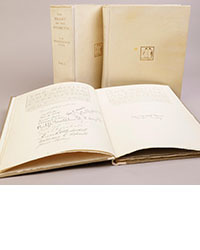
![<b>Scandinavian Art & Rare Books Auctions, Dec. 4:</b> SHACKLETON, BERNACCHI, CHERRY-GARRARD [ed.]: «The South Polar Times» I-III, 1902-1911. <b>Scandinavian Art & Rare Books Auctions, Dec. 4:</b> SHACKLETON, BERNACCHI, CHERRY-GARRARD [ed.]: «The South Polar Times» I-III, 1902-1911.](https://ae-files.s3.amazonaws.com/AdvertisementPhotos/3ee16d5b-a2ec-4c03-aeb6-aa3fcfec3a5e.jpg)
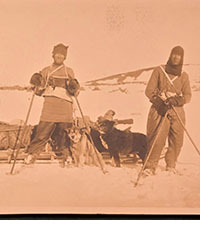
![<b>Scandinavian Art & Rare Books Auctions, Dec. 4:</b> [WILLEM BARENTSZ & HENRY HUDSON] - SAEGHMAN: «Verhael van de vier eerste schip-vaerden […]», 1663. <b>Scandinavian Art & Rare Books Auctions, Dec. 4:</b> [WILLEM BARENTSZ & HENRY HUDSON] - SAEGHMAN: «Verhael van de vier eerste schip-vaerden […]», 1663.](https://ae-files.s3.amazonaws.com/AdvertisementPhotos/d5f50485-7faa-423f-af0c-803b964dd2ba.jpg)
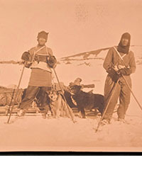
![<b>Scandinavian Art & Rare Books Auctions, Dec. 4:</b> TERRA NOVA EXPEDITION | LIEUTENANT HENRY ROBERTSON BOWERS: «At the South Pole.», Gelatin Silver Print. [10¾ x 15in. (27.2 x 38.1cm.) ]. <b>Scandinavian Art & Rare Books Auctions, Dec. 4:</b> TERRA NOVA EXPEDITION | LIEUTENANT HENRY ROBERTSON BOWERS: «At the South Pole.», Gelatin Silver Print. [10¾ x 15in. (27.2 x 38.1cm.) ].](https://ae-files.s3.amazonaws.com/AdvertisementPhotos/fb024365-7d7a-4510-9859-9d26b5c266cf.jpg)
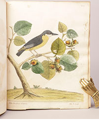
![<b>Scandinavian Art & Rare Books Auctions, Dec. 4:</b> PAUL GAIMARD: «Voyage de la Commision scientific du Nord, en Scandinavie, […]», c. 1842-46. ONLY HAND COLOURED COPY KNOWN WITH TWO ORIGINAL PAINTINGS BY BIARD. <b>Scandinavian Art & Rare Books Auctions, Dec. 4:</b> PAUL GAIMARD: «Voyage de la Commision scientific du Nord, en Scandinavie, […]», c. 1842-46. ONLY HAND COLOURED COPY KNOWN WITH TWO ORIGINAL PAINTINGS BY BIARD.](https://ae-files.s3.amazonaws.com/AdvertisementPhotos/a7c0eda0-9d8b-43ac-a504-58923308d5a4.jpg)
![<b>Sotheby’s, Dec. 11:</b> Darwin and Wallace. On the Tendency of Species to form Varieties..., [in:] <i>Journal of the Proceedings of the Linnean Society,</i> Vol. III, No. 9., 1858, Darwin announces the theory of natural selection. £100,000 to £150,000. <b>Sotheby’s, Dec. 11:</b> Darwin and Wallace. On the Tendency of Species to form Varieties..., [in:] <i>Journal of the Proceedings of the Linnean Society,</i> Vol. III, No. 9., 1858, Darwin announces the theory of natural selection. £100,000 to £150,000.](https://ae-files.s3.amazonaws.com/AdvertisementPhotos/00d5fd41-2542-4a80-b119-4886d4b9925f.png)

