Collections and inventories are organized for retrieval and study and every collection is a combination of items in support of a theme. On June 7th Swann will sell a broad cross section of single images and complete books that will fit into collections of many descriptions. The images include maps and they alone comprise more than half of the sale’s 397 lots. Complete atlases provide an important minority of the lots and a significant portion of the sale’s value. Illustrated books, Audubon images, and various printed images including ephemera round out the material. Many of the lots carry estimates of under a thousand dollars. For individuals looking to enter the auction fray there will be many opportunities to buy well.
The entire sale needs to be examined but here are some examples.
Maps of America can be expensive. Lot 4 is two unusual anonymous maps of America estimated $250-350. The catch? They are in Turkish.
The first a decorative Turkish manuscript map of North and South America showing California as an island. A map made to look old but created for the tourist trade, likely in Istanbul in the latter part of the twentieth century. 16 1/2x12 1/2 inches sheet size, wide margins; light soiling. and: An engraved map of North America without toponyms, bordered by elaborate margins of American fauna. Boundaries of the United States, Canada and Mexico hand-colored in outline; circular printed label "Severnaya America" in Cyrillic alphabet pasted on. 14 1/4x12 inches sheet size; n.p., circa 1845.
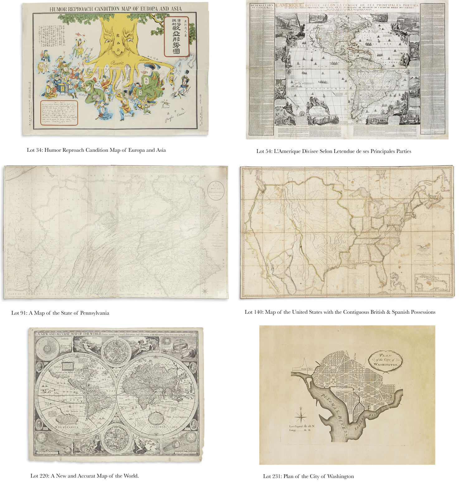
Lot 34
(CARICATURE MAP.) Humor Reproach Candition Map of Europa and Asia. Color-lithographed serio-comic map of Europe and Asia lettered in Japanese and English. 15 1/2x21 1/2 inches sheet size, ample margins; folded in quadrants with small loss at central intersection, small closed edge tears. Japan, 1904
Estimate $1,500 - 2,500
Serio-comic maps of this period were a popular medium to convey the encroachment of the Russian Empire in a humorous and satirical way. A more common form of these maps depicts Russia as a giant octopus with its tentacles reaching out to adjoining countries, however in this rather unique example, Russia is represented as a large tree, expanding its ensnaring roots to the territories beyond. Designed during the time of the Russo-Japanese War, we see many countries wielding axes or knives against Russia, but Japan is actively engaged, chopping at the branch to free Korea; China turns and wags his tongue as the eyes of the giant tree gaze in their direction, wet with tears.
Lot 54
DE FER, NICOLAS. L'Amerique Divisee Selon Letendue de ses Principales Parties. Engraved decorative wall map of North and South America on four sheets joined, bordered by a separately engraved title banner and sheets of extensive explanatory text. 45 1/2x66 inches overall size, wide margins with untrimmed deckle edges; original outline hand-color; minor strengthening to versos of folds and joins. Paris, 1713 (but 1716)
Estimate $20,000 - 30,000
Rather nice example of De Fer's rare wall map of the Americas. Pictorial vignettes surround and elaborate the geography, including many scenes of the inhabitants native to these American continents. Two important commercial elements of the New World are also prominently represented: the Newfoundland cod fishery and the beaver fur trade. The latter, here regarded as the first appearance of the industrious beaver scene against the backdrop of Niagara Falls later greatly popularized by Herman Moll. The cartography shows a very large depiction of California as an island and reflects contemporary Jesuit information of the Great Lakes and inland river systems. Dahl, Edward, "The Original Beaver Map" (TMC 29, pages 22-26); McLaughlin 165; Tooley, "California as an Island" 70.
Lot 64
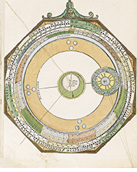
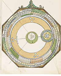
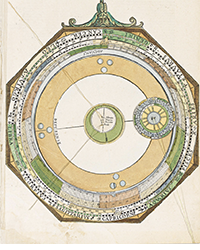
EIMMART, GEORGE CHRISTOPHER. (Globe gores). Together three untrimmed double-page sheets, the celestial globe complete in 24 gores with two polar calottes, the terrestrial with only the southern 12 gores and one calotte. Approximately 22 1/2x25 1/2 inches each sheet size, wide margins with deckle edges; partially hand-colored. Very scarce. Nuremberg, 1705
Estimate $2,000 - 3,000
Lot 81
HOLLAND, MAJOR SAMUEL. The Provinces of New York, and New Jersey; with part of Pensilvania, and the Province of Quebec. Engraved folding map of the colonial northeast on two sheets joined. 54x21 1/2 inches overall size, ample margins; nice original hand-color with later additions; minor foxing. Stevens & Tree 44(e) 5th and final state. London: Sayer & Bennett, 1776
Estimate $1,200 - 1,800
Lot 91
HOWELL, READING. A Map of the State of Pennsylvania. Engraved map printed on four sheets, segmented and archivally joined on verso. 37x62 inches overall size, shaved just outside of neatline; archivally lined on verso, few very minor scattered instances of worm track. London, 1792
Estimate $6,000 - 9,000
Showing the expanse of the state to its western regions, "This is the best map of Pennsylvania to appear in the 18th century, and the first to show its exact boundaries" (Wheat & Brun). Howell's map was the standard for nearly three decades until the publication of John Melish's large map of the state in 1822.
The four sheets were published in several states over a period of time, correcting and adding information as new surveys were reported. Examples of the map are frequently composed of differing states: in the present map, the upper right, lower right and upper left are in the first state, with the lower left in the fourth state. Wheat & Brun 433-435.
Lot 140
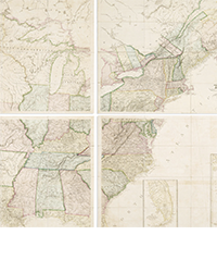
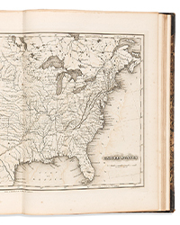
MELISH, JOHN. Map of the United States with the Contiguous British & Spanish Possessions. Engraved case map dissected in 40 sections mounted to original linen with silk edging, folding into marbled paper self-wrappers. 36x58 inches overall size; original outline hand-color; housed in original worn 8vo format morocco backed case with original ties; scattered staining, very minor chipping to fold intersections near title not affecting map. Philadelphia, 1816
Estimate $15,000 - 25,000
A very important piece of American cartography, this map is the first representation of the continental United States to be shown as an integrated landmass from the Atlantic Ocean to the Pacific, systematically incorporating the explorations and mappings of Lewis and Clark, Zebulon Pike, Aaron Arrowsmith, Alexander von Humboldt and others.
Melish continually issued updated editions of his map, printing 23 altered states through 1823. This is Ristow's 7th state of the 1816 first edition with the designation "Mississippi Territory" changed, dividing the states and so naming them Mississippi and Alabama Territory. Ristow, A la Carte, page 173.
Lot 156
(NEW YORK.) De Witt, Simeon. Map of the State of New York. Engraved folding map, dissected and laid on contemporary linen. 23 3/4x28 1/2 inches sheet size, good margins; outline hand-coloring; light staining and offsetting. New York, 1804
Estimate $1,000 - 1,500
Lot 185
(RAILROADS.) Maps of the New and Popular St. Louis and Texas Short Line! Lithographed folding railroad advertisement containing two color-printed maps. 18 1/2x31 inches overall; minor separations at fold intersections, few small spots; contemporary ink stamps of Henry H. Hannan, emigration and land agent, Swan Creek, Ohio. St. Louis: Woodward, Tiernan & Hale, circa 1878
Lot 220
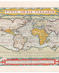
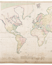
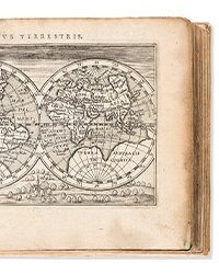
SPEED, JOHN. A New and Accurat Map of the World. Double-page, double-hemispheric decorative world map. 16 1/2x21 1/2 inches sheet size, ample margins, blank verso; minor edge soiling and two small worm holes; an exceptional dark impression and a very attractive example. Shirley 317, 2nd state. London: William Humble, circa 1651
Estimate $6,000 - 9,000
Lot 231
(WASHINGTON, D.C.) [Ellicott, Andrew, after]; Thackara & Vallance. Plan of the City of Washington. Engraved plan of Washington, D.C. on laid paper bearing "SL" countermark. 12 3/4x16 inches sheet size, wide margins; never folded, right edge skillfully cleaned; overall excellent in appearance. Philadelphia: Thackara & Vallance, March 1792
Estimate $3,000 - 5,000
James Thackara and John Vallance were selected by Andrew Ellicott to engrave the manuscript survey of his large official plan of Washington D.C. which was based on Pierre L'Enfant's designs. While completing this task, the engravers cut a smaller version and released it in the March, 1792 edition of The Universal Asylum and Columbia Magazine several months before Ellicott's "official" map would be finished. Thackara & Vallance's pirated version therefore bears the distinction of being the first printed plan of the nation's capital. The present example is a rare separately issued printing of the map, having never been folded for inclusion in the magazine. Baynton-Williams, Plans of Washington, D.C. 1; Goff, A la Carte, page 148; Tooley, Federal City, 1; Wheat & Brun 527.
Lot 277
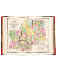
(NEW YORK.) Burr, David H. Atlas of New York. Hand-colored engraved folding frontispiece state map and 67 reverse-printed white on black engraved maps with yellow outline hand-color on 58 leaves. 8vo, 8x5 inches, original faded purple cloth with gilt title blazon on upper cover, needs recasing and rebacking; folding map (19x22 inches) with several repairable splits along fold lines, internally clean with minor offsetting, deaccessioned bookplate and ink stamps of the New Jersey Historical Society. New York, 1838
Estimate $700 - 1,000
A small amount of binding work would result in a dandy little New York atlas, complete with the commonly lacking folding map published by J.H. Colton. Phillips, Atlases 2207.
Lot 297
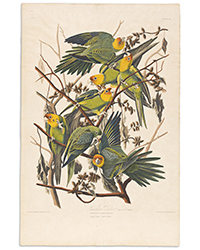
AUDUBON, JOHN JAMES. The Birds of America. Half-titles, subscriber's lists, 500 hand-colored lithographed plates after Audubon. 7 volumes. Royal 8vo, 10 1/4x6 1/4 inches, contemporary half morocco, spines lettered in gilt, light wear, hinges unprofessionally repaired; moderate foxing largely keeping to text and tissue guards, plates seeing scattered offset but generally clean with bright coloring, several plates misbound, foredge shaved close barely affecting a handful of images, waterstain to volumes V-VII gently affecting many plates. Provenance: John Pierce Brace, with his name stamped at each spine foot and ink ownership inscriptions to each title-page. should be seen. New York: J.J. Audubon; and Philadelphia: J.B. Chevalier, 1840-1844
Estimate $25,000 - 35,000
subscriber's copy of the first octavo edition of Audubon's greatly popular Birds of America. Original owner John Pierce Brace spent more than thirty years of his life as an educator to colonial women, serving as headmaster at Litchfield Academy for Girls and later holding the same position at the Hartford Female Seminary. Following his tenure in education, Brace took over the editorship of the Hartford Courant newspaper until retirement at the age of 70. His son, Charles Loring Brace, is the noted nineteenth-century philanthropist and social reformer. The present books are offered by descent through the family.
To view the entire sale you can run your searches in our Upcoming Auctions or click through to Swann at https://catalogue.swanngalleries.com/asp/searchresults.asp?st=D&sale_no=2481&ps=10&pg=1
For questions contact Caleb Kiffer by phone or email:
[212] 254-4710 ext. 17

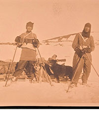
![<b>Scandinavian Art & Rare Books Auctions, Dec. 4:</b> ROALD AMUNDSEN: «Sydpolen» [ The South Pole] 1912. First edition in jackets and publisher's slip case. <b>Scandinavian Art & Rare Books Auctions, Dec. 4:</b> ROALD AMUNDSEN: «Sydpolen» [ The South Pole] 1912. First edition in jackets and publisher's slip case.](https://ae-files.s3.amazonaws.com/AdvertisementPhotos/0a99416d-9c0f-4fa3-afdd-7532ca8a2b2c.jpg)
![<b>Scandinavian Art & Rare Books Auctions, Dec. 4:</b> AMUNDSEN & NANSEN: «Fram over Polhavet» [Farthest North] 1897. AMUNDSEN's COPY! <b>Scandinavian Art & Rare Books Auctions, Dec. 4:</b> AMUNDSEN & NANSEN: «Fram over Polhavet» [Farthest North] 1897. AMUNDSEN's COPY!](https://ae-files.s3.amazonaws.com/AdvertisementPhotos/a077b4a5-0477-4c47-9847-0158cf045843.jpg)
![<b>Scandinavian Art & Rare Books Auctions, Dec. 4:</b> ERNEST SHACKLETON [ed.]: «Aurora Australis» 1908. First edition. The NORWAY COPY. <b>Scandinavian Art & Rare Books Auctions, Dec. 4:</b> ERNEST SHACKLETON [ed.]: «Aurora Australis» 1908. First edition. The NORWAY COPY.](https://ae-files.s3.amazonaws.com/AdvertisementPhotos/6363a735-e622-4d0a-852e-07cef58eccbe.jpg)
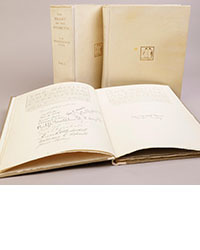
![<b>Scandinavian Art & Rare Books Auctions, Dec. 4:</b> SHACKLETON, BERNACCHI, CHERRY-GARRARD [ed.]: «The South Polar Times» I-III, 1902-1911. <b>Scandinavian Art & Rare Books Auctions, Dec. 4:</b> SHACKLETON, BERNACCHI, CHERRY-GARRARD [ed.]: «The South Polar Times» I-III, 1902-1911.](https://ae-files.s3.amazonaws.com/AdvertisementPhotos/3ee16d5b-a2ec-4c03-aeb6-aa3fcfec3a5e.jpg)
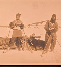
![<b>Scandinavian Art & Rare Books Auctions, Dec. 4:</b> [WILLEM BARENTSZ & HENRY HUDSON] - SAEGHMAN: «Verhael van de vier eerste schip-vaerden […]», 1663. <b>Scandinavian Art & Rare Books Auctions, Dec. 4:</b> [WILLEM BARENTSZ & HENRY HUDSON] - SAEGHMAN: «Verhael van de vier eerste schip-vaerden […]», 1663.](https://ae-files.s3.amazonaws.com/AdvertisementPhotos/d5f50485-7faa-423f-af0c-803b964dd2ba.jpg)
![<b>Scandinavian Art & Rare Books Auctions, Dec. 4:</b> TERRA NOVA EXPEDITION | LIEUTENANT HENRY ROBERTSON BOWERS: «At the South Pole.», Gelatin Silver Print. [10¾ x 15in. (27.2 x 38.1cm.) ]. <b>Scandinavian Art & Rare Books Auctions, Dec. 4:</b> TERRA NOVA EXPEDITION | LIEUTENANT HENRY ROBERTSON BOWERS: «At the South Pole.», Gelatin Silver Print. [10¾ x 15in. (27.2 x 38.1cm.) ].](https://ae-files.s3.amazonaws.com/AdvertisementPhotos/fb024365-7d7a-4510-9859-9d26b5c266cf.jpg)
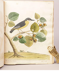
![<b>Scandinavian Art & Rare Books Auctions, Dec. 4:</b> PAUL GAIMARD: «Voyage de la Commision scientific du Nord, en Scandinavie, […]», c. 1842-46. ONLY HAND COLOURED COPY KNOWN WITH TWO ORIGINAL PAINTINGS BY BIARD. <b>Scandinavian Art & Rare Books Auctions, Dec. 4:</b> PAUL GAIMARD: «Voyage de la Commision scientific du Nord, en Scandinavie, […]», c. 1842-46. ONLY HAND COLOURED COPY KNOWN WITH TWO ORIGINAL PAINTINGS BY BIARD.](https://ae-files.s3.amazonaws.com/AdvertisementPhotos/a7c0eda0-9d8b-43ac-a504-58923308d5a4.jpg)
![<b>Sotheby’s, Dec. 11:</b> Darwin and Wallace. On the Tendency of Species to form Varieties..., [in:] <i>Journal of the Proceedings of the Linnean Society,</i> Vol. III, No. 9., 1858, Darwin announces the theory of natural selection. £100,000 to £150,000. <b>Sotheby’s, Dec. 11:</b> Darwin and Wallace. On the Tendency of Species to form Varieties..., [in:] <i>Journal of the Proceedings of the Linnean Society,</i> Vol. III, No. 9., 1858, Darwin announces the theory of natural selection. £100,000 to £150,000.](https://ae-files.s3.amazonaws.com/AdvertisementPhotos/00d5fd41-2542-4a80-b119-4886d4b9925f.png)

