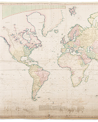
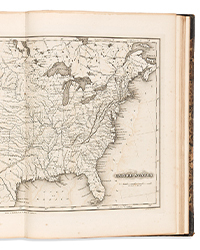
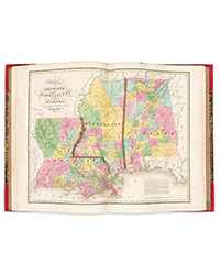
Perhaps the second most popular item in the books and paper field is maps. There are classic maps that go for hundreds of thousands of dollars I'd love to own, but are a bit out of my price range. That's okay. My love of old maps is not so much a desire to display them. It's a wish to follow them, seek out routes long forgotten and trace the foot (or vehicle) steps of earlier travelers.
I spent most of my summer vacation hiking moderate level trails in the high mountains of Colorado and New Mexico, but a few days were devoted to my map obsession. I crossed Coronado's 16th century route through the American Southwest in New Mexico, though no one knows precisely where it is. If you drive from West Texas to Colorado, you must cross it. It would have been exciting to find and follow it, but Coronado did not leave enough details for anyone to locate his route with any degree of certainty, and since 500-year-old footsteps are long erased in the sand, there are no markers left that say he was here. I follow something for which there are still markers – old road maps. In the East, it is unlikely there are many old roads that have not been reused, or otherwise developed. In the West, there are still roads long ago abandoned that remain unused today, slowly being worn to oblivion by the ravages of weather and time.
There were a few long distance roads of sorts in the West during the 19th century, though they were very rough at best. There was the Pony Express Trail and the Butterfield Overland Stage Route that traveled to the west coast, but even they were abandoned before the turn of the century when the automobile made its debut. No one was going to suffer a three-week ride in a bumpy stage coach over rough dirt roads once the railroads came along to provide fast, comfortable service. The first automobiles in the West were mostly limited to driving around their communities, or perhaps as far as an out-of-town farm if the roads were adequate.
By the 1910's, hundreds of thousands of cars now in private hands, citizens groups were formed to promote long distance travel. At that time, there were no federal highways. Roads were maintained, if they were, by counties and states. Most were only for local use, and with the exception of some streets in larger cities, all were dirt. They were filled with potholes and other obstructions, and rain turned them to impassible mud. When snows came, they were shut down entirely.
The private citizens groups who "built" the first interstate roads had no budgets beyond the contributions they received. In reality, they built nothing. What they did was send out explorers who would travel roads in various communities, and look for where they connected with a road from the next town. They would then map out the best long distance route by following the most direct, or best conditioned roads that linked one community to the next. They would publish maps of their findings and then post route signs along the way to guide travelers on their journey.
My own adventures this summer were in West Texas, seeking out portions of the old Bankhead Highway. The first recorded journey from Dallas to El Paso was in 1910 (it's possible someone did it earlier without publicizing it). It took several days and must have been a nightmare. And yet, by 1916, the Bankhead Highway Association was formed to define a road that would go from sea to sea, or more specifically, from Washington to San Diego. The Bankhead was named after Alabama Senator John Hollis Bankhead, who in 1916 spearheaded the Federal Aid Road Act of 1916. It provided a limited amount of matching funds for state highway projects, the first such participation by the federal government.
The Bankhead was not the first coast-to-coast highway. The Lincoln Highway was laid out by 1913. However, the Lincoln followed a more northerly route, which meant it was shut down in the winter. There were no snow plows in the teens. The Bankhead went through Texas for a reason. Running mostly through the South, Texas, and southern New Mexico, Arizona, and California, it was the first cross country highway open year round.
By 1920, the West was covered with such interstate roads, all with names. Some states had begun using route numbers, but there was no federal numbering system yet. So along with the Lincoln Highway and Bankhead Highway, there were roads in the Southwest with names like the National Old Trails Road, Indian Trails Road, Santa Fe Trail Road, Victory Highway (for World War I victory), Dixie Overland Highway, Southern National Highway, and Jefferson Davis Highway. The last of these was created by the Daughters of the Confederacy to balance the aforementioned Lincoln Highway. Nationally, there were over 200 in all.
These names did not last long. The jumble of names made it confusing to travelers, especially since many of the routes followed the same roadways for great distances. In 1926, the federal government set out the highway numbering system in use today. The Bankhead in West Texas became US Route 80. For awhile, names and route numbers coexisted, but soon the names were forgotten, the roads identified by the more convenient numbering system.
By the time the Depression came around, the government became more involved in public works projects. Roads were upgraded, usually converted to "stone roads" (paved highways). In many cases, parts of the patchwork quilt of local roads were replaced with rerouted direct highways, which reduced travel times enormously. Sections of the original routes were abandoned, left to fade away unused.
To locate these old roads you need a few things. Naturally, old maps that show older routes are necessary. Roads are constantly rerouted, but there was particularly heavy activity in the 1930's with the Depression, and 1950's-1960's with the development of the Interstate Highway system. Maps from the 1920's, and 1940's-1950's are good for finding routes abandoned during these eras.
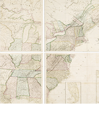
While it is great to have the paper maps themselves, such as those produced by atlas makers, automobile clubs, and my favorite, the ubiquitous oil company road maps long given to travelers free at gas stations, you can easily find old maps online. Many libraries display maps from their collections, fellow highway historians post them, and David Rumsey's wonderful map site is filled with them, though it will take a little trial and error to figure out how best to find the ones you seek.
Along with searching online for maps themselves, you will find many privately run sites that give information about old routes, named ones, state routes, federal routes. Occasionally, you may find an old county map which provides greater detail of a road's location. Finally, a critical tool is Google Maps, and its capacity to be quickly switched to Google Earth, giving you a satellite view of the territory. Sometimes, an old route may be displayed on Google Maps, but if it is long abandoned, it probably won't be. However, long abandoned roads, even dirt ones, will often leave their traces visible from above even a century later. Indeed, roads that may be next to impossible to see from the ground can often readily be deciphered from above. A few years back, ancient Indian trails in the vicinity of Hovenweep National Monument, never noticed from the ground, were spotted on photographs from the sky. These dirt trails had not been traversed in over 500 years and yet their presence was still visible from above. Google Earth is an essential tool.
Now, here is a caution. You cannot assume because the roads were once owned by the federal or state governments, they still are. The land may have been sold off after the road was abandoned, making it private property. In many states, it is okay to walk private property so long as it has not been posted with no trespassing signs. In others, at least Texas, there is no such requirement. You have to figure out whether the property is private or public or just assume it is private. It is a sad state of affairs, especially since the West was once wide open spaces, but while it is unlikely that most large landowners would object to an amateur historian trying to trace his country's roads, no one is going to post a welcome sign on their property. No trespassing is the default. I was so informed, gently, on my search through Texas and will limit further explorations to states with different rules, or better yet, areas with vast amounts of federal land remaining. Beware of those who want to sell off public land to local, private interests. It is your heritage, and freedom to experience what is still part of "this land is your land, this land is my land." Hold onto what is still left.
For the section of the Bankhead Highway I visited, a small portion was still so labeled by Google Maps, though it was a long abandoned dirt road with no real access by anything other than feet or an off-road vehicle. It then disappeared from the map, but traces were still visible from Google Earth. Those traces perfectly matched a strange jog in the original road I found on an old county map. I had located a portion of the original Bankhead Highway. Based on maps I found online, it must have been abandoned around 1930. It was never paved, save for an occasional cement lining covering a wash. Those would have turned to impassible mud during a storm, so the bottom was paved with cement to make it passable, though the rest of the route never progressed beyond dirt.
I parked my car and began a trek of about a mile, with thoughts of what it must have been like for some of the first automobile cross-country travelers of the day. There were no rest areas, public bathrooms, convenience stores, not even gas stations outside of scattered towns along the way. If cars broke down or had flat tires, and those were common occurrences, you better know how to fix them yourself. You might not see a fellow traveler for hours, and if it was late, you would have to sleep under the stars. This was not Oregon Trail, covered wagon difficult, and you were not likely to be accosted by hostile Indians or road robbers in the 1920's. Still, it would have been a great challenge by today's standards.
The road was easy to follow most of the way, with the exception of a few spots where it became overgrown with trees and brush. Finally, I was able to reach my destination, spotted by Google Earth from above – an old wooden bridge. You would not want to drive a car over this 100-year-old bridge that has not felt such a weight in many years, but it was still amazingly sturdy. The surface boards were seriously rotted and not inviting, even for walking, but the wooden support beams underneath were still strong. They built them well in that day.
In the past, I have traveled more recent roads, 1950's vintage in Colorado and Utah. Some are still in use, providing access to ranch land not accessible from an interstate highway. Other sections were totally abandoned, and washed away with gullies so deep not even an all-terrain vehicle could pass. I have stopped at old forts and other structures maintained by the government and historical societies. Their work at preserving our history is fantastic, a wonderful gift to future generations. Still, there is something very special about being able to rediscover a forgotten piece of history yourself, to travel the remnants of the highways used by generations past, one more time before they forever fade away.




![<b>Scandinavian Art & Rare Books Auctions, Dec. 4:</b> ROALD AMUNDSEN: «Sydpolen» [ The South Pole] 1912. First edition in jackets and publisher's slip case. <b>Scandinavian Art & Rare Books Auctions, Dec. 4:</b> ROALD AMUNDSEN: «Sydpolen» [ The South Pole] 1912. First edition in jackets and publisher's slip case.](https://ae-files.s3.amazonaws.com/AdvertisementPhotos/0a99416d-9c0f-4fa3-afdd-7532ca8a2b2c.jpg)
![<b>Scandinavian Art & Rare Books Auctions, Dec. 4:</b> AMUNDSEN & NANSEN: «Fram over Polhavet» [Farthest North] 1897. AMUNDSEN's COPY! <b>Scandinavian Art & Rare Books Auctions, Dec. 4:</b> AMUNDSEN & NANSEN: «Fram over Polhavet» [Farthest North] 1897. AMUNDSEN's COPY!](https://ae-files.s3.amazonaws.com/AdvertisementPhotos/a077b4a5-0477-4c47-9847-0158cf045843.jpg)
![<b>Scandinavian Art & Rare Books Auctions, Dec. 4:</b> ERNEST SHACKLETON [ed.]: «Aurora Australis» 1908. First edition. The NORWAY COPY. <b>Scandinavian Art & Rare Books Auctions, Dec. 4:</b> ERNEST SHACKLETON [ed.]: «Aurora Australis» 1908. First edition. The NORWAY COPY.](https://ae-files.s3.amazonaws.com/AdvertisementPhotos/6363a735-e622-4d0a-852e-07cef58eccbe.jpg)
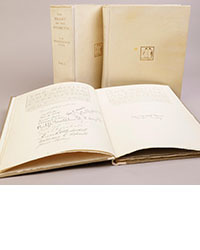
![<b>Scandinavian Art & Rare Books Auctions, Dec. 4:</b> SHACKLETON, BERNACCHI, CHERRY-GARRARD [ed.]: «The South Polar Times» I-III, 1902-1911. <b>Scandinavian Art & Rare Books Auctions, Dec. 4:</b> SHACKLETON, BERNACCHI, CHERRY-GARRARD [ed.]: «The South Polar Times» I-III, 1902-1911.](https://ae-files.s3.amazonaws.com/AdvertisementPhotos/3ee16d5b-a2ec-4c03-aeb6-aa3fcfec3a5e.jpg)
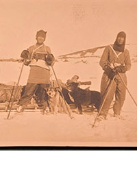
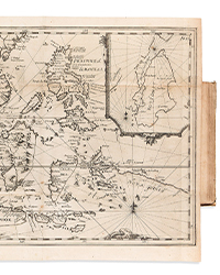
![<b>Scandinavian Art & Rare Books Auctions, Dec. 4:</b> [WILLEM BARENTSZ & HENRY HUDSON] - SAEGHMAN: «Verhael van de vier eerste schip-vaerden […]», 1663. <b>Scandinavian Art & Rare Books Auctions, Dec. 4:</b> [WILLEM BARENTSZ & HENRY HUDSON] - SAEGHMAN: «Verhael van de vier eerste schip-vaerden […]», 1663.](https://ae-files.s3.amazonaws.com/AdvertisementPhotos/d5f50485-7faa-423f-af0c-803b964dd2ba.jpg)
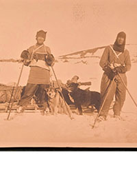
![<b>Scandinavian Art & Rare Books Auctions, Dec. 4:</b> TERRA NOVA EXPEDITION | LIEUTENANT HENRY ROBERTSON BOWERS: «At the South Pole.», Gelatin Silver Print. [10¾ x 15in. (27.2 x 38.1cm.) ]. <b>Scandinavian Art & Rare Books Auctions, Dec. 4:</b> TERRA NOVA EXPEDITION | LIEUTENANT HENRY ROBERTSON BOWERS: «At the South Pole.», Gelatin Silver Print. [10¾ x 15in. (27.2 x 38.1cm.) ].](https://ae-files.s3.amazonaws.com/AdvertisementPhotos/fb024365-7d7a-4510-9859-9d26b5c266cf.jpg)
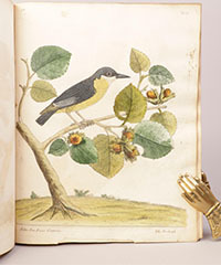
![<b>Scandinavian Art & Rare Books Auctions, Dec. 4:</b> PAUL GAIMARD: «Voyage de la Commision scientific du Nord, en Scandinavie, […]», c. 1842-46. ONLY HAND COLOURED COPY KNOWN WITH TWO ORIGINAL PAINTINGS BY BIARD. <b>Scandinavian Art & Rare Books Auctions, Dec. 4:</b> PAUL GAIMARD: «Voyage de la Commision scientific du Nord, en Scandinavie, […]», c. 1842-46. ONLY HAND COLOURED COPY KNOWN WITH TWO ORIGINAL PAINTINGS BY BIARD.](https://ae-files.s3.amazonaws.com/AdvertisementPhotos/a7c0eda0-9d8b-43ac-a504-58923308d5a4.jpg)
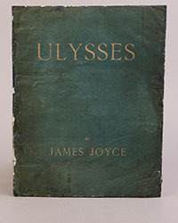
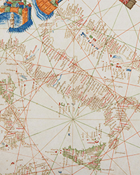
![<b>Sotheby’s, Dec. 11:</b> Darwin and Wallace. On the Tendency of Species to form Varieties..., [in:] <i>Journal of the Proceedings of the Linnean Society,</i> Vol. III, No. 9., 1858, Darwin announces the theory of natural selection. £100,000 to £150,000. <b>Sotheby’s, Dec. 11:</b> Darwin and Wallace. On the Tendency of Species to form Varieties..., [in:] <i>Journal of the Proceedings of the Linnean Society,</i> Vol. III, No. 9., 1858, Darwin announces the theory of natural selection. £100,000 to £150,000.](https://ae-files.s3.amazonaws.com/AdvertisementPhotos/00d5fd41-2542-4a80-b119-4886d4b9925f.png)

