As fall approaches this month, Old World Auctions is doing its part to usher in the new season for map collectors with the third of its four annual online-only sales. With the house’s focus on cartographic material, OWA’s Sale #150 includes 750 lots of maps and atlases, as well as old and rare books with maps, geography books, globes, prints, illuminated manuscripts, and reference books. The sale will go online September 3rd and close September 17th at 10PM eastern.
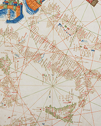
In terms of subject matter, Old World Auctions bills this sale as having a particularly high quality of maps of rivers, islands, and cities around the world. North American rivers including the St. Lawrence, Hudson, Ohio and the fictitious Longue River, as well as European like the Danube, Volga, and Dnieper are all part of Sale #150. Islands found within every ocean are mapped and available for sale—Sri Lanka, Madagascar, Iceland, Cyprus, Cuba, Jamaica, New Zealand, Tierra del Fuego, the British Isles, and Nantucket. And finally plans and views of dozens of cities around the world will be available in the sale; a rare and spectacular bird’s-eye view of Naples, Italy published by Antonio Lafreri being one of the standouts.
Individual rarities are also being featured in the sale. They include the first state of Pedro de Medina’s map of the North Atlantic Ocean, Nuevo Mundo, being the first to depict the Papal Line of Demarcation. Another is John Ogilby’s rare First Lords Proprietors map, A New Discription of Carolina by Order of the Lords Proprietors, which was employed as a promotional tool encouraging expansion and settlement in Maryland and the Carolinas in the late 1600s. Several rare and important maps of Canada including Blaeu’s only map of Canada, Extrema Americae Versus Boream, ubi Terra Nova Nova Francia, and Louis Armand, Baron de Lahontan’s map of Canada and the Great Lakes, Carte Generale de Canada.
The following are ten highlights of the September sale:
- Pitt's Rare Carte-a-Figures Map in Full Original Color. Moses Pitt, Nova Totius Terrarum Orbis Geographica ac Hydrographica Tabula, 1680. Estimate $11000 - $13000
- Extremely Rare First State of Medina's Map. Pedro de Medina, Nuevo Mundo, 1545. Estimate $10000 - $15000
- Rare Edition of Ptolemy's Map of Sri Lanka. Ptolemy/Germanus, Duodecima Asie Tabula, 1486. Estimate $6000 - $7500
- Cellarius' Chart of an Earth-Centric Solar System. Cellarius/Schenk & Valck, Orbium Planetarum Terram Complectentium Scenographia, 1708. Estimate $1600 - $1900
- Stunning and Scarce View of Naples. Antonio Lafreri, Quale e di Quanta Importanza, e Bellezza sia la Nobile Cita di Napole in Italia, 1566. Estimate $7000 - $9000
- Blaeu's Only Map of Canada, Showing the Canadian Maritimes. Johannes Blaeu, Extrema Americae Versus Boream, ubi Terra Nova Nova Francia, Adjacentiaq, 1670. Estimate $2000 - $2300
- One of the Most Decorative and Influential Maps of Southeast Asia. Linschoten/Langren, Exacta & Accurata Delineatio cum Orarum Maritimarum tum Etiam Locorum Terrestrium quae in Regionibus China..., 1596. Estimate $13000 - $15000
- Lahontan's Map of Canada and the Great Lakes. Louis Armand, Baron de Lahontan, Carte Generale de Canada..., 1705. Estimate $2000 - $2400
- Blaeu's Strip-Map of the Dnieper River. Blaeu, Lectori S. Hunc Borysthenis Tractum ut ad Nostrum Geographiae Tabulam..., 1640. Estimate $1600 - $2000
- Ogilby's Scarce and Influential First Lords Proprietors Map. Moxon/Ogilby, A New Discription of Carolina by Order of the Lords Proprietors, 1673. Estimate $12000 - $15000
Registration for the sale can be done via this link: https://www.oldworldauctions.com/ssl/register.asp
Old World Auctions offers a 100% money back guarantee on the authenticity and condition of every item in the auction. They feature a 10-minute rule at the close of the auction, which keeps lots with active bidding open for an additional 10 minutes, until there are no bids on the lot for a full 10 minutes. All of their packaging and shipping is done in-house, and they ship to over 70 countries each year.


![<b>Heritage, Dec. 15:</b> John Donne. <i>Poems, By J. D. With Elegies on the Author's Death.</i> London: M[iles]. F[lesher]. for John Marriot, 1633. <b>Heritage, Dec. 15:</b> John Donne. <i>Poems, By J. D. With Elegies on the Author's Death.</i> London: M[iles]. F[lesher]. for John Marriot, 1633.](https://ae-files.s3.amazonaws.com/AdvertisementPhotos/8caddaea-4c1f-47a7-9455-62f53af36e3f.jpg)











![<b>Sotheby’s, Dec. 11:</b> Darwin and Wallace. On the Tendency of Species to form Varieties..., [in:] <i>Journal of the Proceedings of the Linnean Society,</i> Vol. III, No. 9., 1858, Darwin announces the theory of natural selection. £100,000 to £150,000. <b>Sotheby’s, Dec. 11:</b> Darwin and Wallace. On the Tendency of Species to form Varieties..., [in:] <i>Journal of the Proceedings of the Linnean Society,</i> Vol. III, No. 9., 1858, Darwin announces the theory of natural selection. £100,000 to £150,000.](https://ae-files.s3.amazonaws.com/AdvertisementPhotos/00d5fd41-2542-4a80-b119-4886d4b9925f.png)

